Mapping paratransit routes in Accra : mission accomplished!
Within the framework of the Ghana Urban Mobility and Accessibility Project (GUMAP), funded by the Swiss State Secretariat for Economic Affairs (SECO) and implemented by the Ghanaian Ministry of Local Government, Decentralization and Rural Development (MLGDRD), Transitec and Transport For Cairo (TfC) were mandated to map the public transport routes and passenger flows in the Greater Accra Metropolitan Area (GAMA).
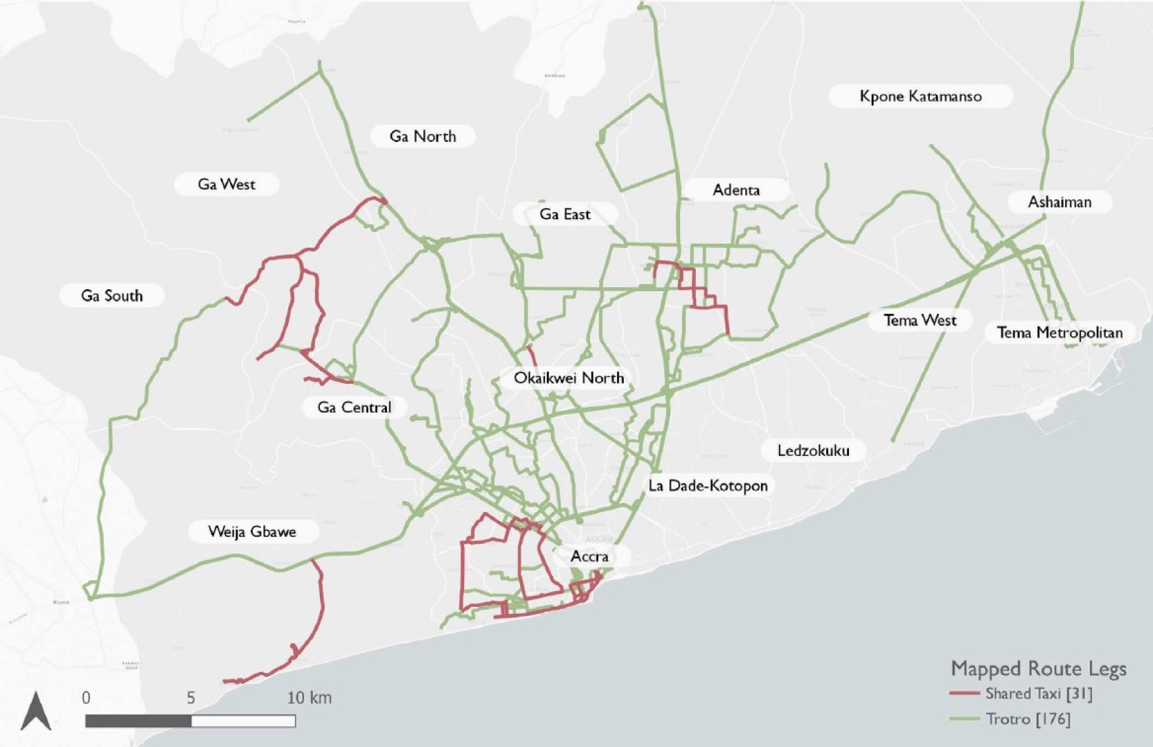
One of the major issues in urban mobility in GAMA is the unsatisfactory performance of public transport, which is essentially provided by second-hand minibuses called “trotros”. However, little is known about the operational characteristics of trotro routes in GAMA. In the absence of baseline data describing the services operating under their jurisdiction, it is difficult for Departments of Transport (DoTs) within the municipalities of GAMA to effectively plan and regulate trotro operations. In view of this, Transitec launched in March 2021 a Short-Term Technical Assistance for the completion of databases and maps of public transport routes and passenger flows in GAMA. The specific objectives of this assignment were:
- to consolidate a sound and simple data collection framework for the DoTs, including survey methods and protocols on how to use the required survey and processing tools;
- to transfer knowledge and skills towards the staff of beneficiary assemblies in order to empower DoTs to carry out data collection, analysis, and monitoring missions autonomously in the future;
- to establish a consolidated database covering a sample of trotro routes across GAMA, including metrics on the spatial characteristics and performance of these routes.
To best meet these objectives, a data collection campaign was launched, with two types of surveys:
- Onboard surveys – These were used to capture data about trotro routes by recording actual trips taken on those routes. Surveyors boarded departing vehicles and recorded various attributes including:
- Trip distance, duration, speed, and itinerary
- Terminal and stops location and name
- Number of passengers boarding and alighting at each stop
- Frequency surveys – These were important for the calculation of headways as well as the estimation of how much demand there is on a route. At terminals, field researchers monitored vehicles departing on a specific route and recorded the time of departure of each vehicle.
The activity has successfully been completed. From the 110 routes surveyed, the study showed that:
- intra-urban trotro routes have an average length of 16 km (one-way) and most trips are below 30km;
- 50% of surveyed trotros have a headway below 20 minutes, and 75% have a headway below 32 minutes. The average headway is 24 minutes;
- trotros tend to stop at major hubs (Lapaz market, Madina etc.) which would require investment to improve interchanges and improve the overall travel time and passenger experience.
- Both trotros and shared-taxis have distance-based fares, with slightly higher fares for shared-taxis. This is explained by the lower capacity and the higher efficiency in short journeys, as it fills-up more quickly than trotros.
This work shall serve as a basis for subsequent updates of the database by the Departments of Transport and shall constitute a tool for decision-making.


Contact

Lausanne
Avenue Auguste-Tissot 4
1006 Lausanne
Switzerland
+41 21 652 55 55